GIS and Survey Mapping
Of all the different things that civil engineering has to offer, GIS (which is short for Geographic Information Systems) has to be one of the most groundbreaking. Ever since engineering’s earliest days, this science has evolved substantially over the years. Now, technology helps civil engineering on such an important note, that it basically covers everything related to civil engineering projects. GIS stands out for empowering all civil engineering ventures in an important way.
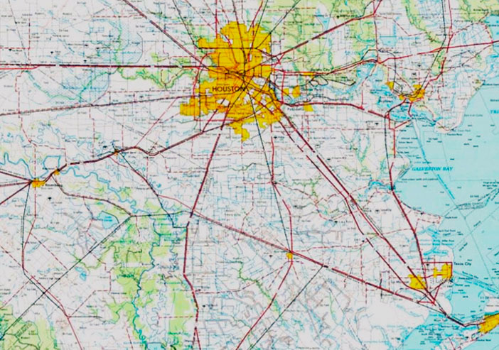
What Geographic Information Systems does is to allow engineers to record and analyze spatial information. This can also be achieved through 3D scanning, which is another relevant method civil engineers use nowadays. What civil engineers do after acquiring all this collected data is to present it in layered visualizations, through digital geographic maps.
Civil engineering has found that GIS delivers an important service, the likes of which has rarely been seen before. Among the many insights provided by GIS, digital mapping and structural imagery are perhaps the most useful. Statistics show that GIS and spatial analytics market are both expected to reach almost $89 billion by 2020. Most of what is covered by this data is related to civil engineering projects. GIS technology has risen to become a major tool for civil engineering, and so far, it looks as if it’s only going to get bigger. Because of this, investors and stakeholders all across America are looking to get into GIS.

Orlando Terán, P.E., R.P.L.S.
Director GIS and Survey Mapping
GIS is providing a groundbreaking contribution to civil engineering, and as such, to all industrial, and public infrastructure projects out there. GIS contributes to engineering by providing the necessary data on top of digital maps to help engineers and other invested parties in producing a more accurate design. The decisions they make are also expected to be better informed, due to this accuracy.
When treating a single 2D map of a certain city, engineers now have the choice of overlaying the base map and obtaining geographically important data from that analysis. This is made possible by GIS.
The information provided by GIS is a lot more accurate than traditional planning methods, given that it also captures spatial difficulties that usually escape the grasp of architects and analysts. A digital scanning made through GIS is sure to deliver as accurate results as any other method.
- GIS
- 3D Scanning
- Civil Engineering
- Project Management
- Aerial Drone Services
- Surveying and Mapping
- Subcontracting Services

At JDM Group Company, we have made it our task to develop a set of state-of-the-art techniques and methods, so that our civil engineering projects are always of great quality. Our years of success, and over completed different projects, show that this commitment to our craft has been effective.
As we do with other technological features, GIS is an instrumental part of our engineering vision, which is why all the projects we carry out are signifcantly improved by it.


